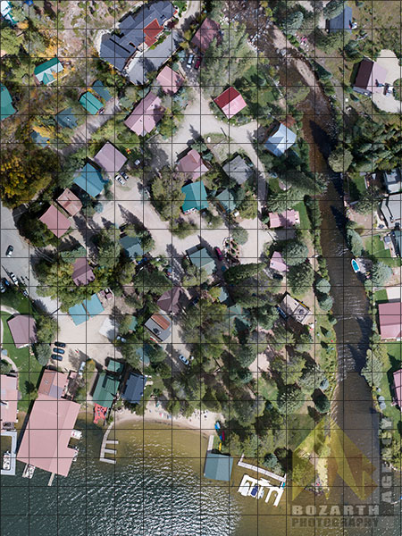
Aerial Survey Grid Created for Land Replat Project
Many businesses can benefit from an eagle eye view of their project or event. We specialize in creating customized site survey videos and photography for ventures such as construction, real estate, and surveying/plats.
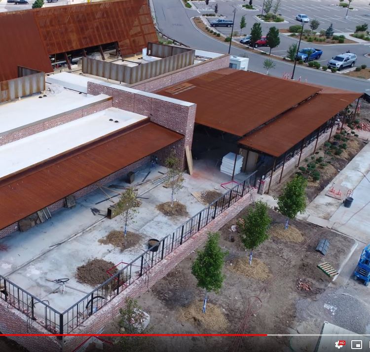
The above featured video is an example of a construction project site survey completed for a investment firm responsible for the construction of a restaurant in Colorado. This allowed the firm to gain a clear picture of build progress and features being added or changed on the project. Our use of drones allows for access that would not be possible with helicopters due to flight restricted areas and population.